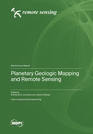
| Judul | Planetary Geologic Mapping and Remote Sensing / Edited : Kaichang Di; Long Xiao; Jessica Flahaut |
| Pengarang | Kaichang Di Xiao, Long Flahaut, Jessica |
| Penerbitan | Basel : MDPI - Multidisciplinary Digital Publishing Institute, 2026 |
| Deskripsi Fisik | 328 p :ilus |
| ISBN | 978-3-7258-7852-9 |
| Subjek | REMOTE SENSING |
| Catatan | The Reprint features 15 papers published in the Special Issue “Planetary Geologic Mapping and Remote Sensing”. Most studies target the Moon using Chang’E, LROC, and other mission data, covering high-resolution DEM generation, buried basin identification, surface chemical inversion via machine learning, crater degradation, and basalt chronology near Chang’e-4 landing area. Technical advances include spherical triangular mesh for lunar product registration and illumination-robust robotic mapping. Other works investigate Ceres cartography, Mercury DEMs from MESSENGER, and the Altiplano-Puna Volcanic Complex as a planetary analog. A review proposes long-distance exploration for lunar Mare Fecunditatis. These studies improve mapping methods, data applications, and geological interpretations for deep-space exploration. |
| Bentuk Karya | Tidak ada kode yang sesuai |
| Target Pembaca | Tidak ada kode yang sesuai |
| Lokasi Akses Online |
https://www.mdpi.com/books/reprint/12913-planetary-geologic-mapping-and-remote-sensing |
| No Barcode | No. Panggil | Akses | Lokasi | Ketersediaan |
|---|---|---|---|---|
| 260226192 | 621.367 8 Pla | Baca Online | Perpustakaan Pusat - Online Resources Ebook |
Tersedia |
| Tag | Ind1 | Ind2 | Isi |
| 001 | INLIS000000000168834 | ||
| 005 | 20260605021636 | ||
| 007 | ta | ||
| 008 | 260605################|##########|#|## | ||
| 020 | # | # | $a 978-3-7258-7852-9 |
| 035 | # | # | $a 0010-0626000079 |
| 082 | # | # | $a 621.367 8 |
| 084 | # | # | $a 621.367 8 Pla |
| 245 | # | # | $a Planetary Geologic Mapping and Remote Sensing /$c Edited : Kaichang Di; Long Xiao; Jessica Flahaut |
| 260 | # | # | $a Basel :$b MDPI - Multidisciplinary Digital Publishing Institute,$c 2026 |
| 300 | # | # | $a 328 p : $b ilus |
| 505 | # | # | $a The Reprint features 15 papers published in the Special Issue “Planetary Geologic Mapping and Remote Sensing”. Most studies target the Moon using Chang’E, LROC, and other mission data, covering high-resolution DEM generation, buried basin identification, surface chemical inversion via machine learning, crater degradation, and basalt chronology near Chang’e-4 landing area. Technical advances include spherical triangular mesh for lunar product registration and illumination-robust robotic mapping. Other works investigate Ceres cartography, Mercury DEMs from MESSENGER, and the Altiplano-Puna Volcanic Complex as a planetary analog. A review proposes long-distance exploration for lunar Mare Fecunditatis. These studies improve mapping methods, data applications, and geological interpretations for deep-space exploration. |
| 650 | # | # | $a REMOTE SENSING |
| 700 | 1 | # | $a Flahaut, Jessica |
| 700 | 1 | # | $a Kaichang Di |
| 700 | 1 | # | $a Xiao, Long |
| 856 | # | # | $a https://www.mdpi.com/books/reprint/12913-planetary-geologic-mapping-and-remote-sensing |
| 990 | # | # | $a 260226192 |
Content Unduh katalog
Karya Terkait :